
Finding Torrance Streets by Address
The cleanest Torrance street directory workflow starts with one complete address and ends with a set of labeled records. Do not flatten a grantee, permit applicant, listed occupant, or registered voter into the word resident. Each role has a different custodian and date. First decide whether the address is inside the incorporated city. Then normalize the street spelling, accept the Assessor suggestion, and save the AIN before following any name trail.
- Check the Torrance records page and city or county boundary context. A postal Torrance line can route a permit or police request outside city government.
- Enter the street number and name in the LA County Assessor Portal. Remove a unit number only when needed to find the base parcel, then record the accepted AIN and situs address.
- Open the map and click the target parcel, then note the lots immediately left, right, and behind it. Corner parcels may face the cross street.
- Use the AIN and legal description to connect the parcel to recorder instruments, secured tax information, and permit records. These sources show property or project roles, not a complete household.
- For an earlier address, search the 1922-1975 Torrance and South Bay directory run by name and street section, then compare the listed sequence with the Herald and census.
Resolve a Torrance Street to an AIN
The AIN is the stable bridge in a Torrance street directory. The Assessor Portal’s Basic Search accepts an AIN or address, while Legal Search helps when a deed uses a subdivision, lot, or block description. Map Search lets a researcher browse mapped parcels one at a time. The accepted autocomplete suggestion matters because directional words, suffixes, and unit numbers can change the result. If no result appears, try the base parcel, check the postal jurisdiction, and confirm that the number is not part of a larger multiunit parcel.
| Assessor control | Type | Required | Use in a street search |
|---|---|---|---|
| Basic Search | Tab | No | Address or AIN starting route |
| Legal Search | Tab | No | Legal-description clues |
| Map Search | Tab | No | Mapped parcel browsing |
| Search by AIN or Address | Autocomplete text | Yes | Exact or suggested parcel |
| Zoom, pan, and parcel click | Map controls | No | Adjacent-lot review |
The Assessor’s public card may show situs, use, characteristics, assessed land and improvement values, tax-rate area, a map link, and recent transfer context. The public portal suppresses an unrestricted owner-name browse, so an address is the honest entry point. A mailing address can belong to a trust, business, service, or other notice recipient and is not the same as situs.
The representative LA County parcel detail illustrates the detail route after a parcel is selected.
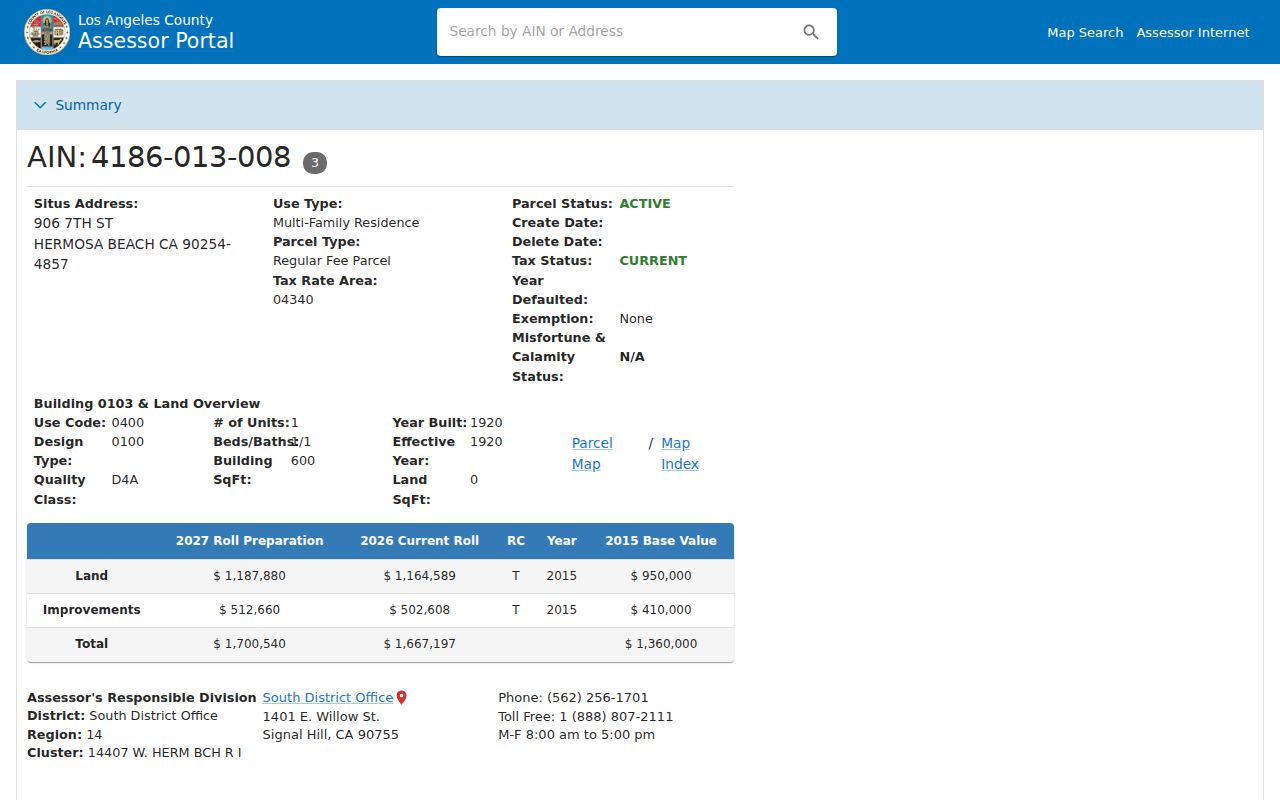
The parcel detail view anchors a Torrance street directory search to an AIN and legal parcel, which can then be carried into other record systems.
Browse Torrance Blocks in the Parcel Map
Map browsing supplies the block angle that a text search cannot. Search the target address, switch to the map, zoom until lot lines are clear, and click the parcel. Save the target AIN. Then click the parcels on each side and behind it, repeating the same detail path. Pan to the opposite street face and flag corners separately. House-number order is not a safe substitute for geometry because a corner lot may carry a situs on the cross street, while a condominium or apartment parcel may contain several units.
Torrance GIS and mapping adds municipal planning or zoning context. The county parcel map and city limit layer should be compared where a postal address says Torrance but the parcel is unincorporated. A map layer can establish a boundary or parcel relationship. It cannot establish who occupies a building, and it does not create a public radius export of people.
For a block log, use a simple order such as target, left, right, rear, and opposite face. Keep the AIN, situs, jurisdiction, map date, and any permit or directory date in separate fields. This makes a Torrance street directory reproducible without turning a map into a harvested household list.
The Assessor map route is the documented free parcel-browse channel. If a parcel fails to load, capture the street spelling and try the city GIS page before treating the result as absent.
The assessor service image reinforces that map and parcel questions belong with the county office, even when the street carries a Torrance postal name.
Torrance Records Searchable by Street
Address-keyed records answer different parts of the same Torrance street directory question. The table below keeps the evidence roles distinct. A parcel is the current map key. A deed is an ownership instrument. A permit is a project record. A voter record is a restricted registration record. A reverse directory is a historical listing made during a canvass.
| Record set | Keeper | Address clue | Access and limit |
|---|---|---|---|
| Assessor parcel | LA County Assessor | AIN, situs, characteristics, values | Free address/AIN search; not a full people list |
| GIS parcel map | Assessor and Torrance GIS | Lot lines, adjacent parcels, jurisdiction | Free map clicks; no resident export |
| Deeds and liens | LA County RR/CC | Legal description and recorded parties | Office index or copy route; no open web name index |
| Permits | Torrance or responsible county department | Address, parcel, work, applicant | Archived portal or account-based search |
| Voter status | LA County RR/CC | Self-supplied address combination | Four fields; full data restricted |
| Criss-cross directory | Torrance Public Library | House number and listed occupant | Digitized historical volumes; gaps possible |
Use the AIN to connect current parcel facts to a deed or permit, and use the street wording to connect an older address to a directory. A name seen in one row should not be copied into another row without an independent anchor. That discipline is the difference between a street directory reference and an unsupported claim about a household.
Situs, Mailing, and Legal Keys in Torrance
Torrance address research has three keys that often look alike but do different work. Situs is the physical parcel address. Mailing is where an assessment or tax notice goes. A legal description identifies the land through lot, block, tract, or other durable language. USPS standardizes delivery, the Assessor maps the AIN, and a deed relies on legal description. A modern street label may change while the parcel and legal chain remain legible.
- Parcel
- A mapped piece of land with an AIN and county assessment record.
- Situs address
- The physical location assigned to the parcel, which may differ from the mailing destination.
- Plat
- A recorded map that helps identify lots, blocks, streets, and subdivisions.
- Criss-cross directory
- A historical street-order section that links a house number to a listed person or business.
For an older Torrance address, keep the spelling as printed, then add the modern AIN or lot and block in a second field. Do not retrofit a current ZIP code into a pre-1963 directory entry. If a street name or number is uncertain, compare maps, permits, deeds, and the directory’s own street sequence before claiming that a record is missing.
Torrance Permit History by Street Address
Permit records can explain why a parcel changes shape or why a directory trail seems to skip a year. Torrance’s archived document portal uses Street Number and Street Name fields, with a Submit button. The more recent Citizen Access system may search Record Number, Address, or Parcel and requires an account or login for permit searching. The city guide directs a user through Building and Grading with Street No. From and Street Name. Older material can remain in the archived route even when Accela returns no result.
A permit can identify work, dates, applicant, contractor, or project context. It does not prove that an applicant owned the parcel or that a named person occupied it. Building plans are inspected at the One-Stop Permit Center rather than assumed to be downloadable. If the address is outside Torrance municipal limits, route building or enforcement questions to the responsible LA County department.
The Torrance Citizen Access portal shows the current permit-search route.
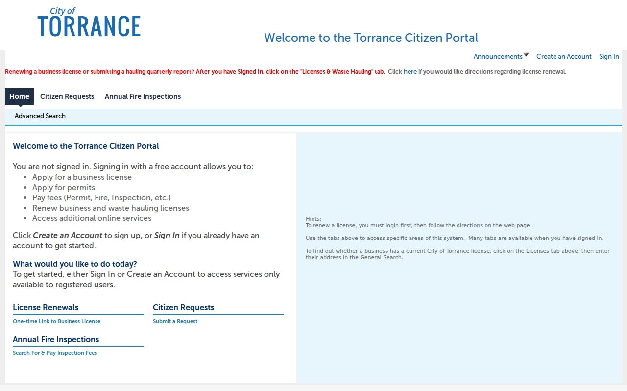
The permit image belongs in the address chain after the AIN is known, adding construction history without changing the meaning of a resident record.
Trace Torrance Ownership Through Grantor and Grantee
Recorder research proceeds by people and legal descriptions, not by assuming that a present street address appears in every historical deed. Start with the current acquisition deed when available. Read the grantee, recording date, and legal description. Then search that grantee’s earlier acquisition, where the prior seller becomes the next grantor or the chain requires an office index review. The county’s recorded books begin in 1850, but a remote name search is not the normal public channel.
Secured tax information can add a current AIN and bill context, but it is not a deed substitute. Property-tax material can show a bill or payment status. It does not establish that a person lived at the situs. The LA County secured property-tax page is useful as a parallel address check.
The tax page image shows a supporting trail around the AIN. Ownership history still belongs to RR/CC recorded instruments and the grantor-grantee index.
Note: The RR/CC maintains documents from 1850, but that coverage date identifies the record era, not a promise that every 1850 page is online.
Read a Torrance Street in Criss-Cross Volumes
The Torrance and South Bay directories from 1922 through 1975 can be approached two ways. Alphabetical pages find a surname, spouse, occupation, and home address. A criss-cross section starts with a street and house number, then gives the listed occupant or telephone. Browse the page image when OCR fails, and copy the abbreviation key from that volume. A mark such as h, r, wid, or ret belongs to that book’s conventions and should not be treated as a universal code.
Directory residence and assessor ownership are different evidence roles. A listed person may be a household member or business contact, while the parcel record may show a different grantee. Pairing the street section with the Herald can explain a move, a death notice, or a business change. The full collection and year-by-year reading method are kept on the Torrance city directory collections page so the Torrance street directory remains focused on the address key.
Why Voter Status Cannot Browse Torrance Streets
The LA County status form requires last name, birthdate, house number, and ZIP. That design permits a submitted self-check and blocks a simple browse of everyone registered along a Torrance street. Elections Code sections 2188 and 2194 and Government Code section 7924.000 restrict home address, telephone, email, precinct, identifying numbers, and signatures. A full voter-file request must use the county’s voter-information process, state an authorized purpose, define geography and fields, and accept redistribution limits.
Even a permitted voter record is not a complete street directory. Registration can become inactive, status can lag a move, and a person may use a protected address through Safe at Home. Aggregate Reports of Registration can support civic research without exposing individuals. For current parcel browsing, use the Assessor map one parcel at a time instead of promising a voter list.
Note: An inactive registration is not proof that a person moved, and a property record is not proof that every listed owner lives at the address.
The 90502 Torrance City-Limit Trap
ZIP geography is the most common Torrance street directory error. USPS assigns ZIP Codes for delivery, while city government uses municipal boundaries. The city warns that a Torrance postal address can lie in unincorporated Los Angeles County. The 90502 postal area is the clearest caution, but boundary checks also matter near Gardena, Los Angeles, and the Palos Verdes edges. A ZIP name alone cannot choose a permit, police, or planning custodian.
Use USPS to standardize the mailing line, GIS to check the government boundary, and the Assessor to identify the parcel. Then route a request to Torrance or the responsible county office. The same three-system check helps when a directory uses an old postal zone, when a deed retains a subdivision name, or when a modern address has a changed street suffix.
What a Torrance Street Directory Misses
A street directory can miss people for ordinary reasons: the source is restricted, the listing is old, the person uses a different name, a multiunit parcel is indexed as one property, or the person never appears in that record set. Utility customers, delivery recipients, children, protected participants, and many household members are not a public street list. DMV personal information is restricted by the federal Driver’s Privacy Protection Act and California law.
Lawful personal use. Use address records for genealogy, property curiosity, reconnecting, or a defined civic request. Do not use a Torrance street directory to stalk, harass, intimidate, or harm anyone. Verify the role and date with the source custodian.
A lack of result is not proof that a person never lived on a street. It may mean that the record is offline, restricted, indexed under an old address, or held by another department. Keep the distinction between an absent record and an absent person at the center of any by-address search.